
blah blah blah
Bald Mountain (Campton)
Length: 2.6 mile loopDifficulty (click for info): Easy
Elevation Gain: 560 feet (+100 feet on descent)
Rating (click for info): 6/10
Elevation: 2206'
Prominence: 299'
Driving Directions:
Trailhead is on Cook Hill Road in Campton, NH. To get there, get off I-93 at exit 28 and follow Rt. 49 to its west end at Rt. 3. Turn left (south) and immediately bear right onto Dan Web Road to Ellsworth Hill Road. Soon turn right onto Ellsworth Hill Road and drive 1.5 miles (passing a scenic overlook) and turn left onto Mason Road. Continue 1.1 miles over dirt, then pavement, then dirt again, to a T-junction. Turn right onto the rougher, hilly Cook Hill Road and drive 0.9 miles to the end of the road. Near the end, the road turns sharply left and ends at a gate that is marked private property (only restricted for hunting). The property is actually a Forest Society conservation easement. Click here for a Google map.
About the Hike:
Sharing a name with over 30 other New Hampshire mountains and likely thousands worldwide, this particular Bald Mountain does not bear any clues to the origin of its name. It is densely forested up to the top with the exception of a narrow ledge strip around the highest point that opens up a little bit of a view over the Baker River Valley. Located in the town of Campton in a semi-remote area of logging and pasture land, Bald Mountain is the peak on a long, winding eastern extension of more well-known Stinson Mountain. A seldom-used, unofficial trail traverses the mountain's horseshoe-shaped northern side and takes in some of the scenic forest environment. The highlight of the hike is the view from a logged clearcut 2/3 of the way down from the summit, where a sweeping panorama of the White Mountains is had. Peace and quiet is a near-certainty on this little-known hike.
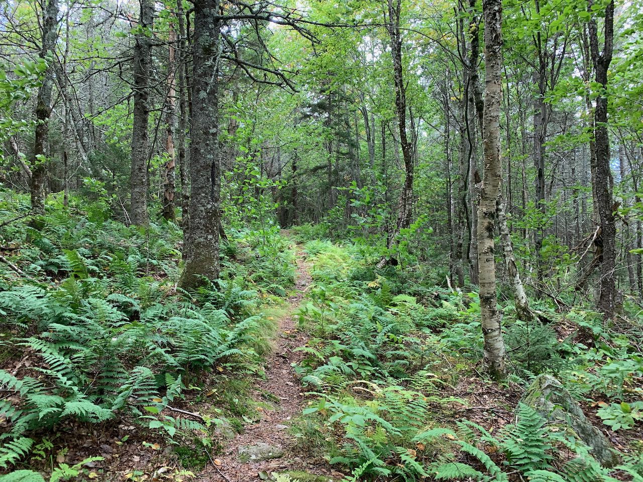
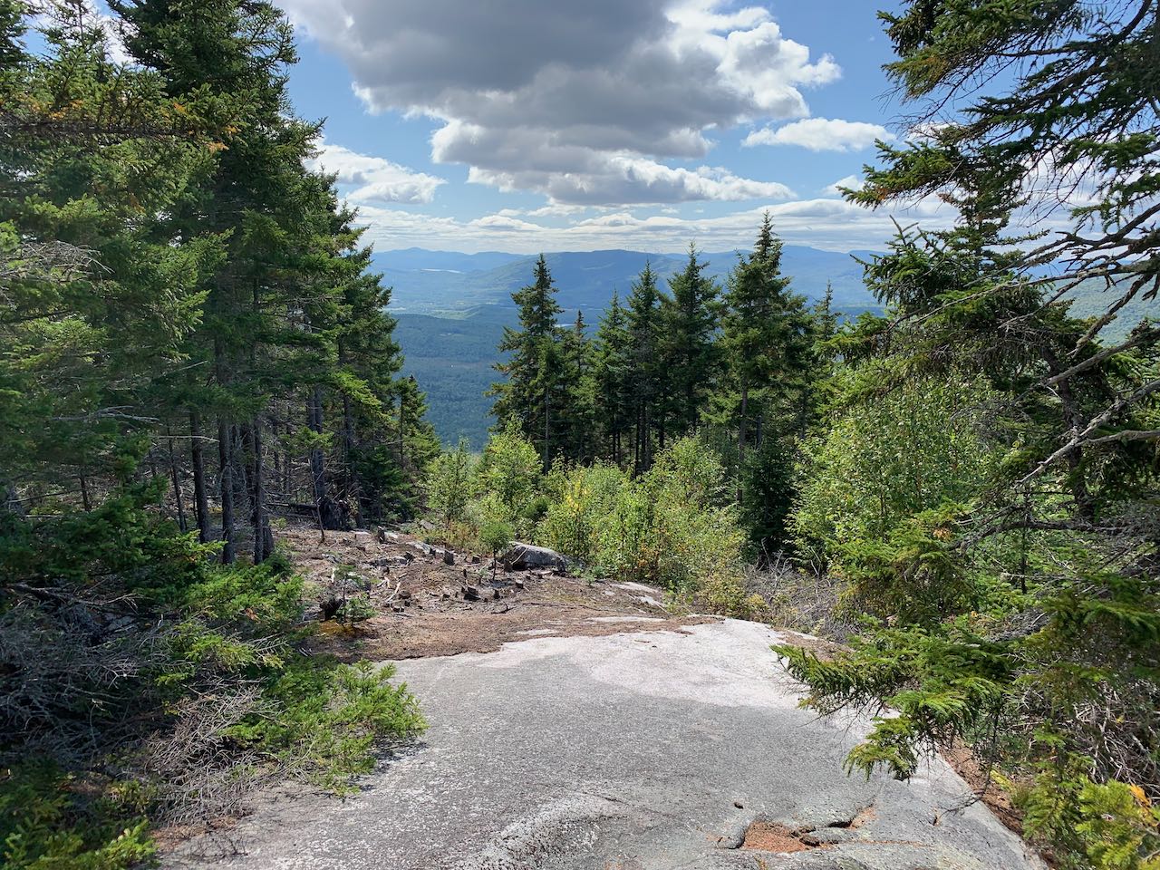
Continue 300 feet past the gate on foot and arrive at a logging landing. This is where the loop splits, although there is nothing indicating that it is a hiking trail. Bear left and head to the back of the clearing (not the road continuing straight; that is where you will return from the loop). Turn left and walk uphill, following the edge of the clearing. As you enter the woods, you will find the trail. It is an obvious and wide path that is easy to follow for the rest of the way. The trail heads uphill at moderate grades through open forest for 0.3 miles, then swings right and climbs gently near the top of a ridge for another 0.3 before cutting through some surprisingly dense spruce forest for 2000 feet. It then drops 0.1 miles into a small col, making an unnecessarily long switchback before starting the final climb to the summit. It heads directly uphill for 0.2 miles, climbing up through some beautiful fern-filled ledges. The summit is at the top of a long, sloping ledge where trees have been cleared to open up a viewpoint. The view is decent here, but nothing compared to the spectacular view you will have much further down on the descent. It's still a nice spot to spend some time at, and there are views of Tenney Mountain and the Baker River Valley, with Mt. Cardigan in the distance.
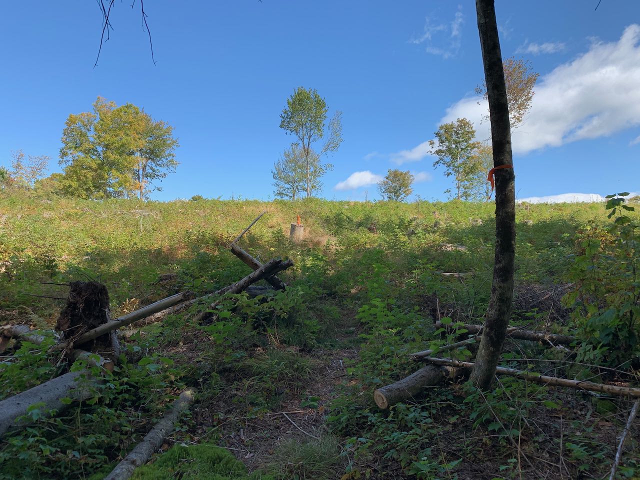
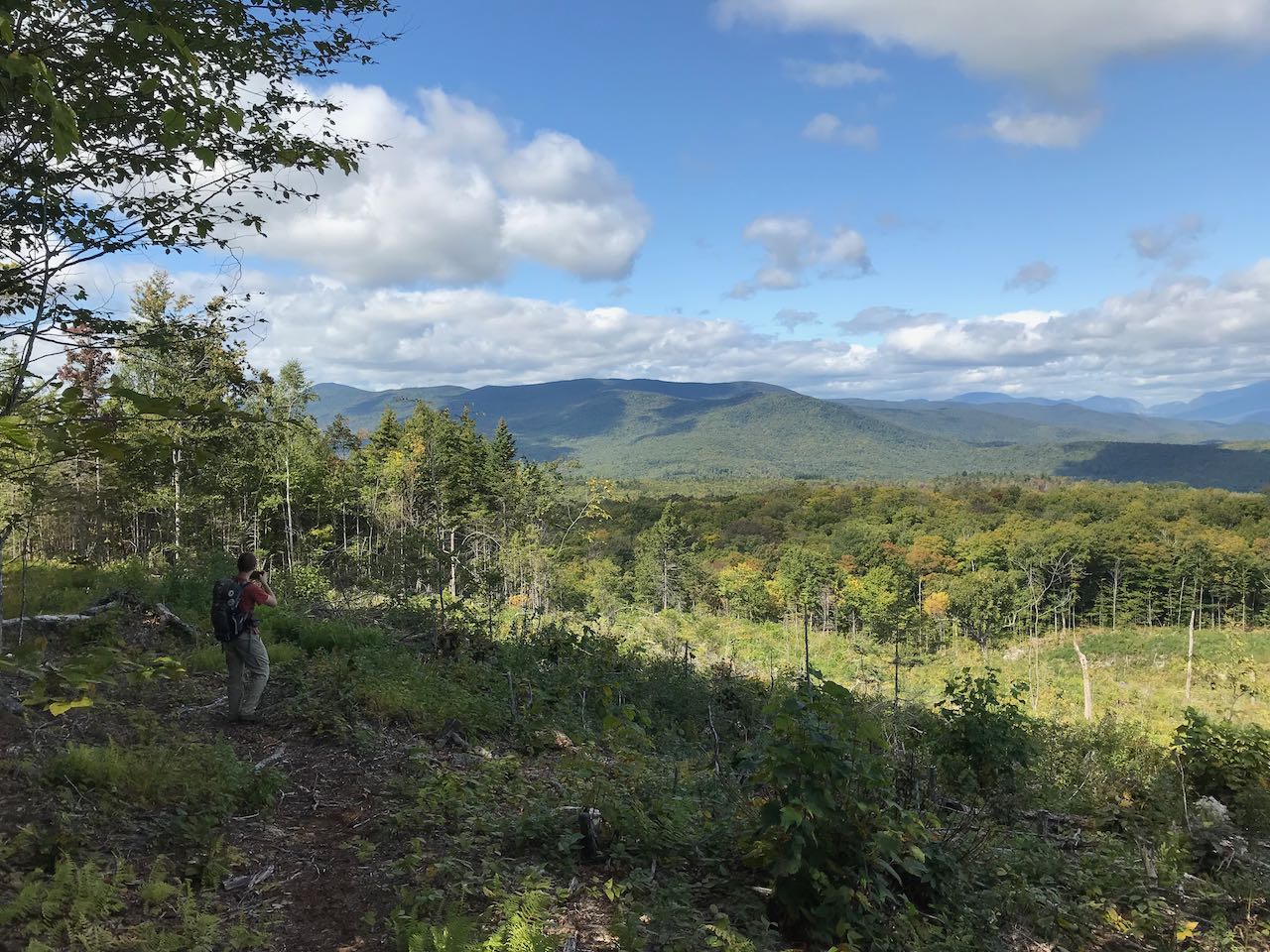
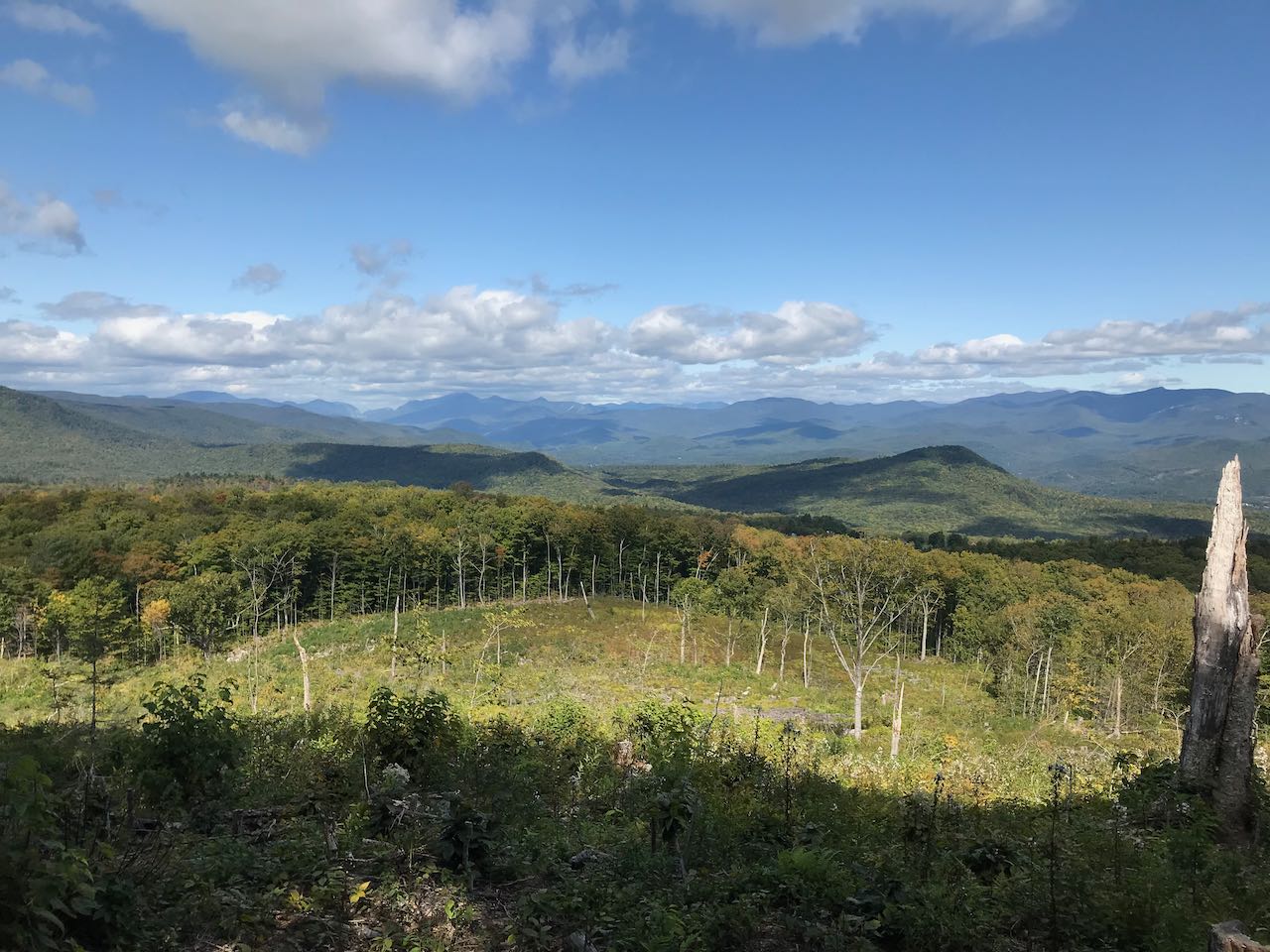
The trail past the summit runs along the top of the ledge, then heads straight down the ridge for 0.4 miles along a moss-lined footway. Reaching a flat shoulder, it crosses a large logged clearcut, where you must pay careful attention for infrequent trail markers to guide you to the other side, 0.1 miles away. Continue descending for another 0.1 miles to an area with four large stone foundations. Look for a herd path on the left and follow it 250 feet out to the edge of a huge logged clearing where you will find the best view of the entire loop, taking in a fantastic southern profile of the White Mountains. The panorama stretches from Franconia Notch to the Sandwich Range. Walk further out into the center of the clearing for the most open view. Up close on the left, you see the broad mass of Stinson Mountain. The first distance peaks you see to the right are those of the Kinsman Range - the Kinsmans, the Cannon Balls, and Cannon Mountain. A clear view straight through Franconia Notch is had, with the sharp Eagle Cliff in the back. To the right of the notch rises the lofty Franconia Range - Mts. Lafayette and Lincoln with the peaked summits of Liberty and Flume separated. The Twin Range is seen further back to the right. Next over, the undulating spine of Scar Ridge leads up to Mt. Osceola. More prominent to the right is Mt. Tecumseh, with its southern basin in full view, with ledge-splotched Mts. Welch and Dickey down below, blocking Waterville Valley off from view. The distinctive three summits of Mt. Tripyramid are seen in back next over, and Sandwich Dome is the massive mountain all the way to the right, if you are far enough out into the clearing. Past this, back on the trail, it's an easy half-mile walk back to the trailhead. Continue on the path, which is now an old road and follow it 0.2 miles down to the logging road you started on. Bear right, cross a clearing, and in a quarter mile you are back at the start.
Printable directions page